


|
U.S. Rectangular Survey System Approved Florida Board of Professional Surveyors and Mappers – Course No. 7585
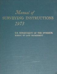
Course Description: This correspondence course provides instruction in the United States Public Land Survey System. The course teaches principles and concepts needed in the practice of surveying and mapping. The course is based on Chapter 3 (The System of Rectangular Surveys) of the U.S. Department of the Interior publication by the Bureau of Land Management entitled "Manual of Surveying Instructions 1973".
Course Topics: Meridians and Baselines Standard Parallels and Guide Meridians Subdivision of Townships and Sections Meandering Limits of Closure
Course Objectives: The objective of "U.S. Rectangular Survey System HS" is to present information that will assist the surveyor in understanding the rectangular survey system used in the United States' Public Land Survey System.
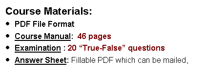
Evaluation Method: A written examination will be used to determine if the course objectives have been met. The student must achieve a minimum of 70 percent correct answers in order to receive continuing education credit.
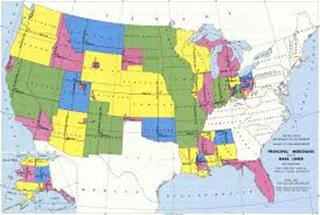
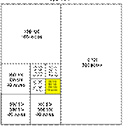
Course Outline 1. General Scheme 2. Initial Points 3. Principal Meridian 4. Base Line 5. Standard Parallels 6. Guide Meridians 7. Township Exteriors, · Regular Order, Irregular Order, Partial Surveys, Allowable Deviation in Bearing, Completion of Partially Surveyed Exteriors, Retracements, Resurveys, Rectangular Limits, Defective Exteriors, Closing Error · Subdivision of Townships, Regular Boundaries, Irregular Boundaries, Closing Lines 8. Subdivision of Sections 9. Subdivision by Protraction 10. Subdivision by Survey Order of Procedure, Subdivision of Sections into Quarter Sections, Subdivisions of Fractional Sections, Subdivision of Quarter Sections, Subdivision of Fractional Quarter Sections 11. Survey of Parts of Sections 12. Fractional Townships 13. Extension and Completion Surveys Completion of Partially Surveyed Sections, Completion of Township Subdivision 14. Meandering Rivers, Lakes, Islands, Use of Photogrammetry 15. Limits of Closure 16. Marking Lines Between Corners |