


|
Live Presentation Webinar Land Boundaries: Chapter 177 F.S.
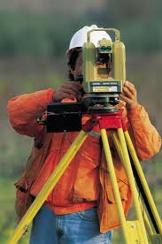
Course Description – “Land Boundaries: Chapter 177 F.S.” Florida Board of professional Surveyors and Mappers – Course No. 7427 6 HR. Continuing Education Credit Instructor: David Melvin, PLS, CFM
“Land Boundaries: Chapter 177 F.S.” is a six hour course that teaches the laws and rules given in Chapter 177 Florida Statues regarding Land Boundaries.
Course Topics – “Land Boundaries: Chapter 177 F.S.”
· Boundary Survey Requirement · Naming Subdivisions and Streets · Plat Approval Process · Vacation of Plats · Recording Requirements · State Plane Coordinates · Coastal Land Boundaries · Certified Corner Reports
Course Objectives – “Land Boundaries: Chapter 177 F.S.” The objective of “Land Boundaries: Chapter 177 F.S.” is to teach the laws and rules given in Chapter 177 Florida Statues regarding Land Boundaries.
Detailed Outline – “Land Boundaries: Chapter 177 F.S.”
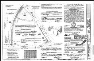
PART I: Platting (ss. 177.011-177.151) This portion will cover each sub-section of Part 1 in detail with particular emphasis on sub-section dealing with plats made for recording (ss. 177.091).
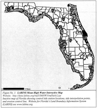
PART II: Coastal Mapping (ss. 177.25-177.40) This portion will be a general overview of Part II with emphases on sub-section dealing with standards for establishment of local tidal datum (ss. 177.38). Procedures and methods for tide observations or the determination of local tidal datum will not be included in this seminar.
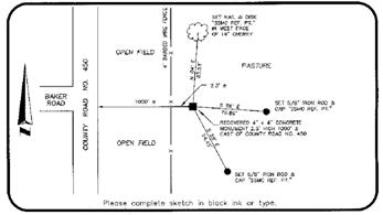
PART III: Restoration of Corners (ss. 177.501-177.510) This portion will cover each sub-section of Part III in detail
|